Interactive Holy Land Map
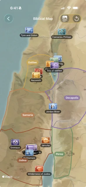
Explore the Holy Land like never before. An illustrated map layered over real satellite imagery lets you discover where biblical events unfolded and see the land Jesus walked.
Explore the Holy Land like never before. An illustrated map layered over real satellite imagery lets you discover where biblical events unfolded and see the land Jesus walked.
Pan and zoom across the Holy Land with satellite imagery and a hand-drawn illustrated overlay.
Select any pin to open a detailed view with historical context and geographic information.
Discover the biblical events that happened at each place and the Scripture passages connected to it.
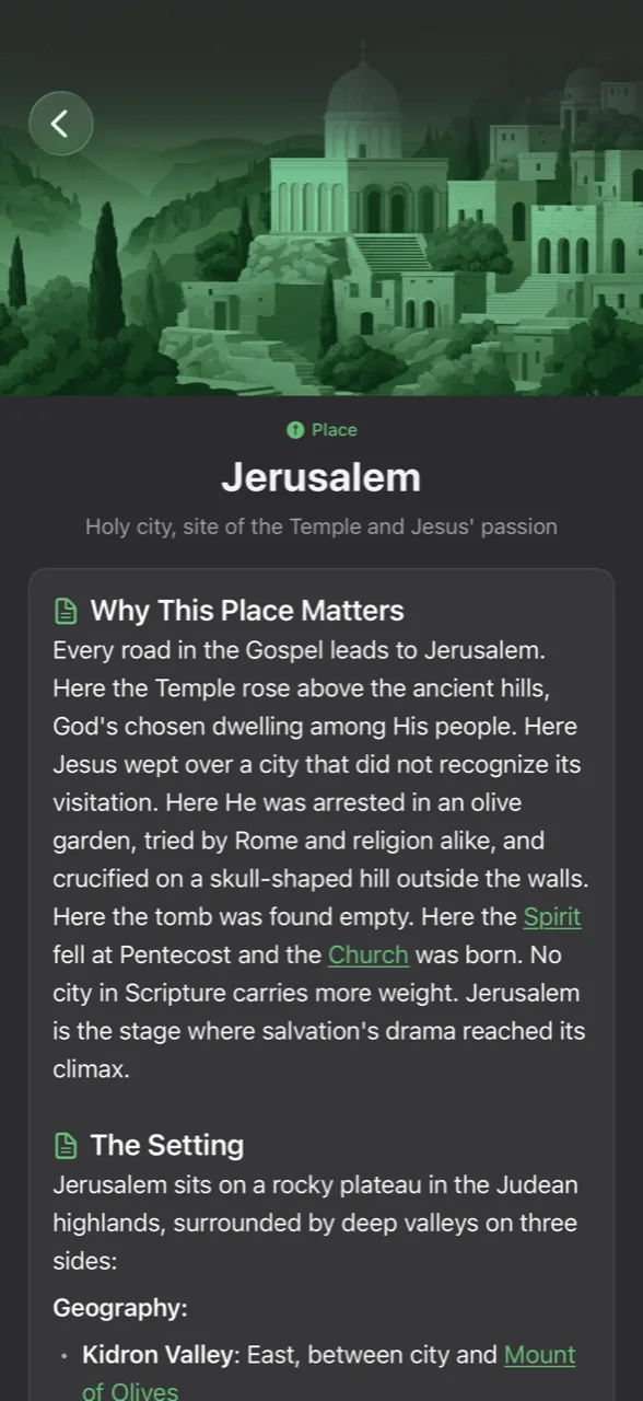
Tap any location to see its full story. Each entry includes historical background, geographical details, and the Scripture passages tied to that place, so you can understand the world behind the words.
See the real terrain of the Holy Land with satellite imagery, enhanced by a clear illustrated overlay for easy reading.
Each location comes with rich historical background that helps you understand what life was like in biblical times.
Every location links directly to the Bible passages where it appears, so you can read the stories that happened there.
The map includes key biblical locations across the Holy Land, from Galilee to Jerusalem and beyond. Each location features historical context, connected Scripture passages, and details about the events that took place there.
It is both. The map layers a hand-drawn illustrated overlay on top of real satellite imagery, so you can see the actual terrain of the Holy Land while enjoying a clear, readable map experience.
Yes. The map highlights locations central to Jesus' life and ministry, including Bethlehem, Nazareth, Capernaum, the Sea of Galilee, and Jerusalem. Tap any location to read about the events that happened there and the Scripture passages connected to it.
Explore the Holy Land from your pocket. Download My Daily Bread and discover the places behind the Bible.